Chances are you’ve ordered something online recently and your purchase arrived via truck to your post office, home, or workplace. Now online retailers want to deliver your packages using drones.
Sounds simple enough, especially if the lightweight, unmanned vehicles have to zip over rural areas only. Yet once they hit a city like Chicago, turbulent wind forces could deplete their power supplies and send them spiraling off course.
That’s why drone designers look to researchers such as Candace Wark (Ph.D. MAE ’88), IIT professor of mechanical and aerospace engineering, whose fundamental airflow research can inform ways to program drones to better navigate urban environments.
“We know quite a bit about atmospheric flow in general, so we have an idea of what to expect in terms of the wind gust levels above Iowa farmland. But when that airflow makes its way into a city, the interaction between the wind and the buildings creates a very complicated flow problem,” Wark says.
Walk downtown in any major city and you’ll experience the familiar gusts that travel down the sides of tall buildings and through the intersections. For the past 25 years—including her early days as a Ph.D. candidate—Wark has worked in the Mark V. Morkovin Wind Tunnel studying the unique dynamics of these urban airflow patterns. Her research has revealed some surprising results that highlight their complexity.

“In looking at a city like Chicago, if the wind flow is coming directly out of the west and then shifts to the north or the south by just five degrees, that can drastically change the flow patterns throughout the downtown area,” she says. “I didn’t expect it to be that large of a change for that small of an angle.”
Understanding and building models to predict these complex airflow patterns could allow drone designers to develop navigational systems that map the best routes through a city given the variables of a particular day. Other applications include charting the dispersion of air pollution or the potential flow of contaminants introduced accidentally, or intentionally, into the air above or around an urban environment.
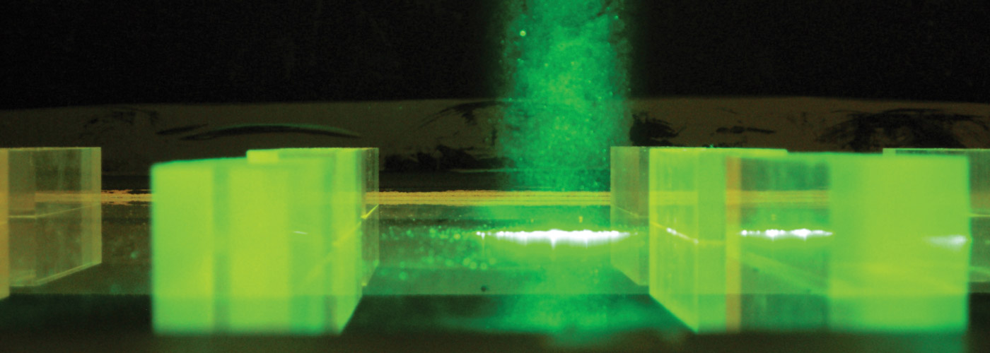
So how do you study something invisible, such as wind? For starters, you contain it in a tunnel where you can manipulate, measure, and map its currents.
Wark and her students set up models—such as rows of Plexiglas blocks—in the Morkovin tunnel’s test section to simulate an urban environment, and then use lasers and cameras to capture the movement of aerosol particles at various wind speeds through the mock urban array. Airflow patterns can also be visualized by introducing smoke into the tunnel via a technique that involves sending an electric current through an oil-slicked wire. The latter method is one Wark uses to create artistic images of flow patterns [see Airflow Art], which recently were featured in an exhibit at Willis Tower in Chicago.
Data collected from Wark’s wind tunnel experiments flows to Dietmar Rempfer, IIT professor of applied mathematics/mechanical and aerospace engineering, who uses it to build predictive models that one day may help drones navigate the windiest of cities.